- Úvod
- Exhibitions
- Temporary exhibitions
- Historical development of land surveying

Historical development of land surveying
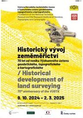
The exhibition was created on the occasion of the 70th anniversary of the founding of the Research Institute of Geodesy, Topography, and Cartography (VÚGTK), a public research institution. Through texts, visual materials, and displays of instruments and tools from the development workshops of VÚGTK, it presents the history and current work of this public research institution, whose societal contributions are extraordinary.
The mission of the institute, which was established in 1954, is applied and basic research in the field of geodesy, surveying, and cadastre, as well as the development and testing of new methodologies, procedures, and software tools, along with providing expert consultations. Domestic and international projects, which bring significant societal benefits and play an important role in terms of social relevance, are of great importance for the institute's further development. The exhibition presents three areas: the institute’s history, its current activities, and research projects in the field of international and national cooperation.
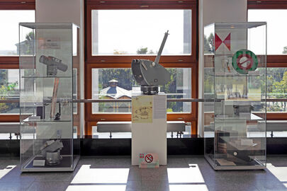
On display at the exhibition are instruments and tools from the development workshops of VÚGTK, some of which are part of the collections of the National Technical Museum (NTM). Among those selected by the museum are items from the 1960s and 1970s – a circumzenithal instrument for determining latitude and longitude, triangles for plotting rectangular coordinates, a circular coordinatograph used for plotting polar coordinates onto plans and maps during cadastral surveying, and a graph-theodolite for positional mapping in mining environments. From the VÚGTK objects, there is, for example, a sensor for hydrostatic leveling, which is used to monitor height shifts on the foundation slabs of the turbine generator and reactor at the Temelín Nuclear Power Plant, as well as other types of circumzenithals, a prototype electro-optical rangefinder, and measuring and cartographic tools.
The NTM’s cooperation with VÚGTK also extends to various projects. The “Virtual Map Collection” is one of the outcomes of the project Cartographic Resources as Cultural Heritage and is accessible on the website www.chartae-antiquae.cz. Another collaboration took place on the project “Surveying and Astronomical Instruments Used in the Czech Republic from the 16th to the End of the 20th Century,” which can be found on the website www.surveyinginstruments.org. This project included the joint exhibition “How the World is Measured,” held at the NTM, along with a book of the same name. Recent collaborations include the project “Large-format Archival Materials” from the NAKI program / Ministry of Culture of the Czech Republic and the professional digitization of map collections from the NTM archive.
Photogallery


